Topographic Maps
Learning to understand a topographic map that shows elevations will be worth the investment of time.
Back in the early 1990's we had a huge 24 hour rainstorm in my village. I had a rain gauge set up and it indicated that we received about 5.75 inches of rain in that 24 hour period. We had widespread flooding of many houses in my village. Many people couldn't believe how small creek beds that usually only have a trickle of water in them turned into virtual rivers.
Numerous houses had extensive basement flooding caused by streams that overflowed their banks and crushed garage doors and even basement doors in a matter of moments.
The point of the story is that just about everyone of these people never thought they would have a problem. Their houses and building lots didn't seem to be in a danger zone. After the storm and flooding were over, it was obvious that the damaged houses were in low spots or near the bottom of shallow valleys. It took a 100 year storm to point out the problem. This is why you need to think ahead when you buy a lot.
Bathtub Ring
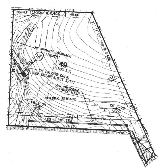
Have you ever notice rings inside of bathtubs? If the tub drains slowly, you will see a number of rings that stair step down toward the bottom of the tub. Each ring represents the level of the water within the tub at a given moment in time. The ring also represents a perfectly level line as standing water in a tub, bottle, pond or lake is level due to the forces of gravity.
You can use this same principal to help you understand the funny crooked, curved and squiggly lines you see on a topographic map. Each of these lines is like a ring in your bathtub. They represent a layer of land or earth that is the exact same height above sea level.
Topographic maps allow you to get an idea of the three dimensional (3D) configuration of the land while looking at a two dimensional piece of paper. It is that simple.
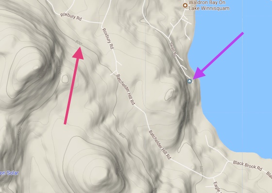
This is a topo map from Google Maps. You just select the Terrain option from the menu to see it. Note the red arrow pointing to the gray lines that have numbers on them. Any point on that line is the same distance above sea level as the number.
Column B289